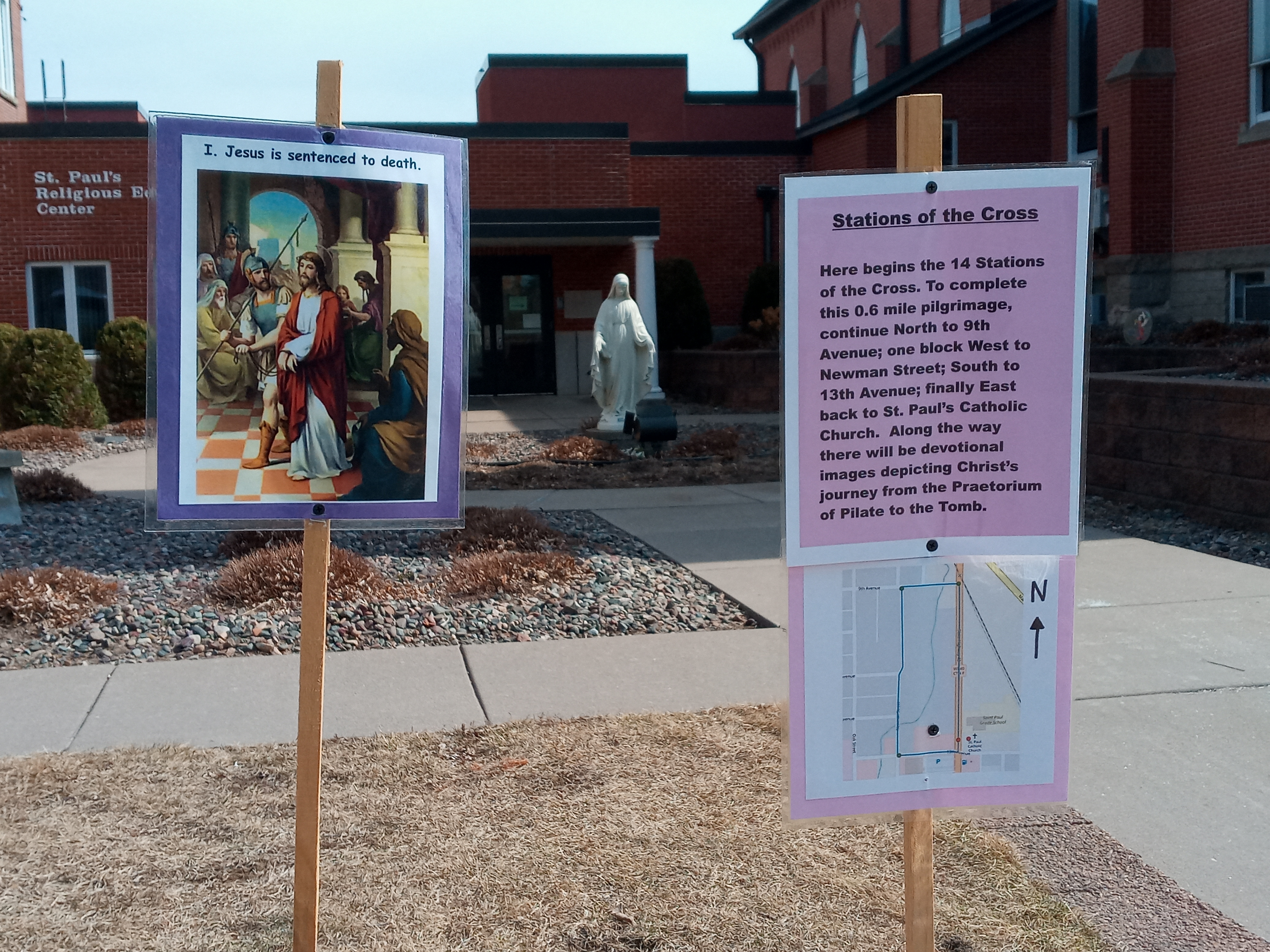
Our 1st Station, with an introduction and a map of our Way of the Cross
The experience of visiting the Holy Land (as I did in 2016) gives a person lasting impressions. One is a deepened sense that the Gospel stories were not “once upon a time” but events of a real time and place. Another takeaway is a better sense of the region’s scale – which is smaller than what you would think. The size of the nation of Israel is less than New Jersey, and the area enclosed by the walls of Jerusalem’s Old City (0.35 square miles) is that of only one-and-a-half Vatican City’s. The Way of the Cross, from where Governor Pilate sentenced Jesus to death to the place of Christ’s death and burial, is about 600 meters or 2,000 feet, less than half a mile.

Remember in the film “The Passion of the Christ,” when Jesus falls and Mary rushes to him? This is my photo of the 3rd and 4th Stations in Jerusalem.
In the Holy Land I also learned that Christian tradition not only preserves details about Jesus’ Passion (such as his three falls and St. Veronica’s veil) but also commemorates the locations at which these sad moments occurred. These fourteen Stations of the Cross are still venerated and prayerfully walked by pilgrims in Jerusalem today. It is a powerful, beautiful experience which I wanted to recreate in the streets of my community, and which you might wish to offer yours.
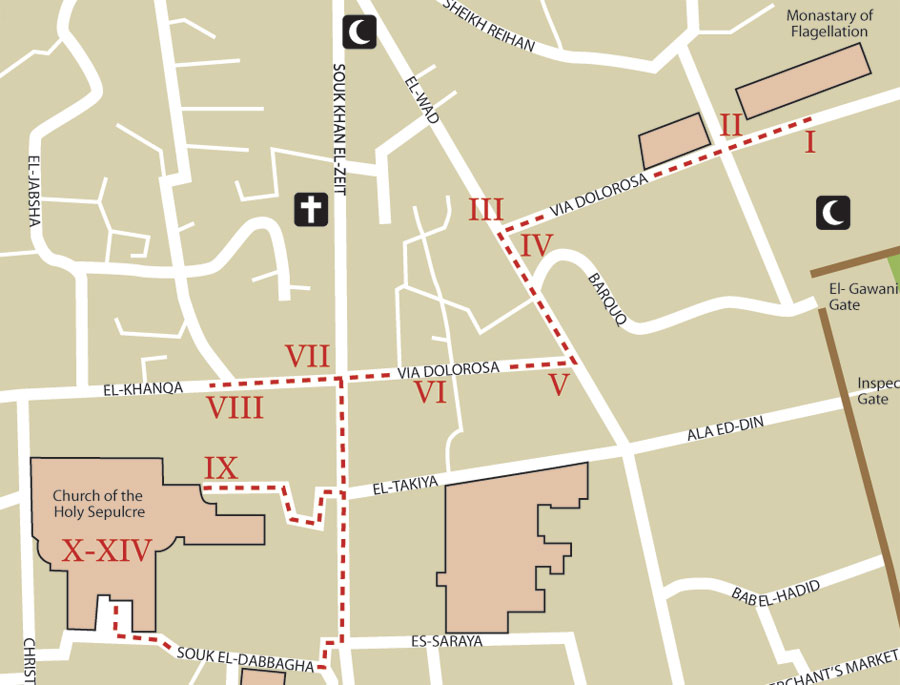
A present-day map of the fourteen Stations on Way of the Cross in Jerusalem
This Lent, we’ve created an outdoor Way of the Cross. It begins in front of our church and school and loops one time around the city block opposite them. After measuring maps and receiving permission from the various landowners, we posted the traditional fourteen Stations along a path which approximates the actual Way of the Cross, both in its length and its distances between the Stations. Walking it takes about twelve minutes (if one does not pause to pray) and we plan to keep the Stations up until Easter Sunday. Our small-town, local newspaper even ran a story about them.

The final five Stations, commemorating Jesus’ crucifixion and burial, are grouped closely together near the end. This is because the locations of Jesus’ Cross and Tomb were situated only about 150 feet away from each other. Both sites are now housed within the Church of the Holy Sepulchre. On Good Friday, the Roman soldiers led Jesus west outside the walls of Jerusalem to a white limestone quarry. St. John’s Gospel records that many people read the sign posted above our Lord’s head on the Cross indicating the “crime” for which he was condemned (“Jesus the Nazorean, the King of the Jews”) because the place where he was crucified was near the city. It was also apparently alongside a road, since St. Matthew notes “those who passed by hurled insults at him.” Christ was crucified atop a rock formation there called Golgotha in Hebrew and Calvary in Latin, which laborers had cut around and left behind. As Psalm 118:22 had foretold, “the stone which the builders rejected has become the cornerstone.”
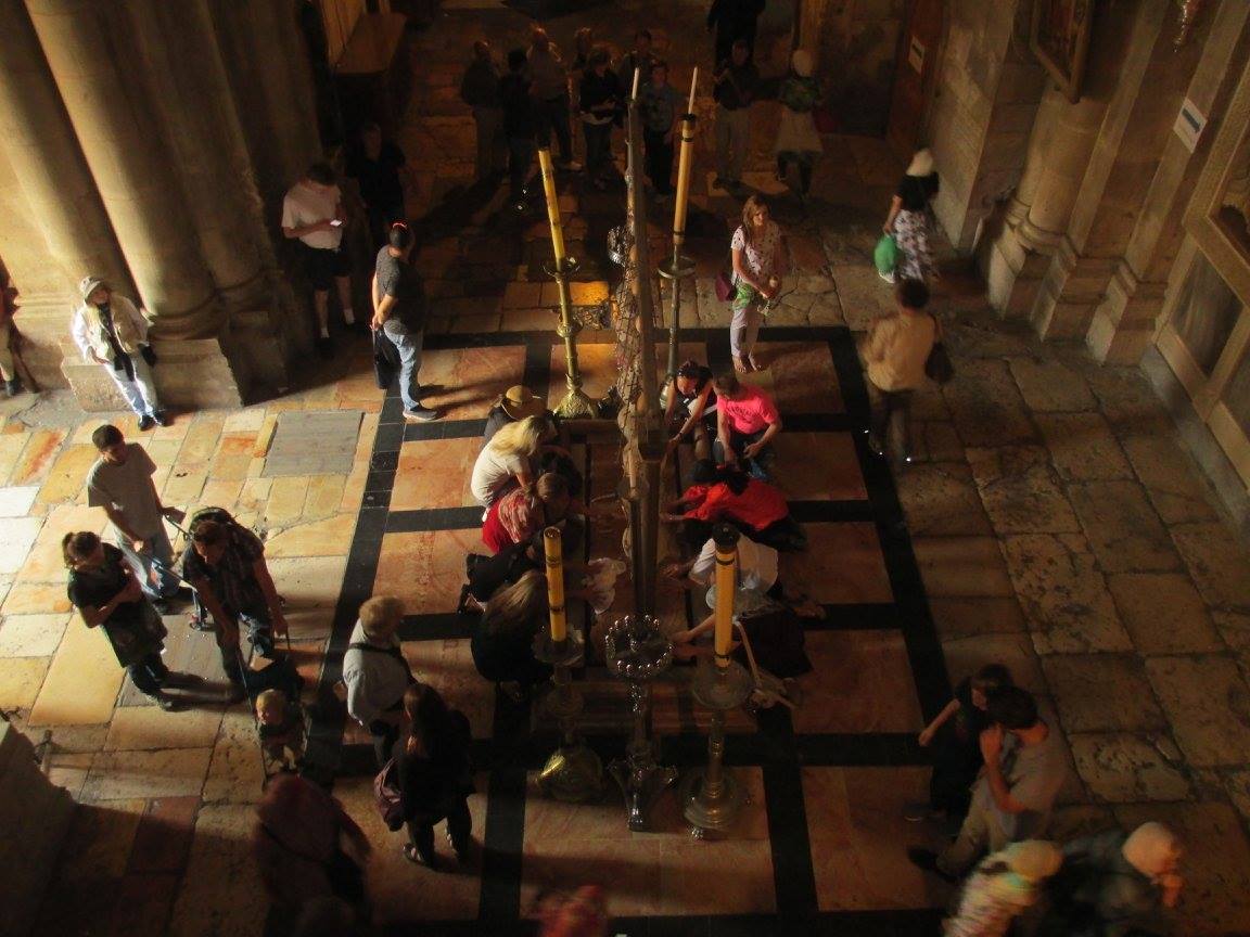
A view from Calvary of the Stone of Unction in The Church of the Holy Sepulchre
The new tomb which St. Joseph of Arimathea gave to Jesus had been cut into a rock face amidst a garden nearby. Midway between these two places, the Church of the Holy Sepulchre now displays a stone venerated as the slab upon which Jesus’ body was prepared for burial by his mother and his friends. In whatever ways you accompany Christ through his sufferings this Lent, may you come to share more greatly in the graces and joys of his Easter Resurrection.

Leave a comment